 KAI-Twin: digital twins of basins, wellfields and networks
A live model of your basin, wellfield or network.
KAI-Twin
Digital twins of basins, wellfields and networks
Planners and operators look at different spreadsheets and cannot test what happens if a pump fails, a drought deepens or a flood arrives.
KAI-Twin will run a live model of a basin, wellfield or water network, fed by sensors and satellites, so teams can test scenarios before they happen.
What it will do- Live model fed by sensors and satellites
- Flood, drought and failure scenarios
- One picture for planners and operators
- Built on GroundWater Analyst, HydroSaaS and KAI-Hydro
Early access is free. Members hear first when it launches and get an introductory price.
Products you can use now
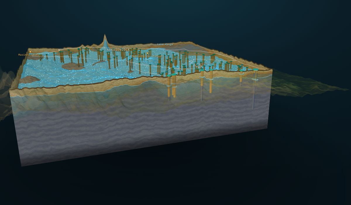
 GroundWater Analyst
3D groundwater models from borehole records: water table, bedrock, aquifer layers, boreholes and flow, with cross-sections anywhere.
Free plan · paid from $149 per site
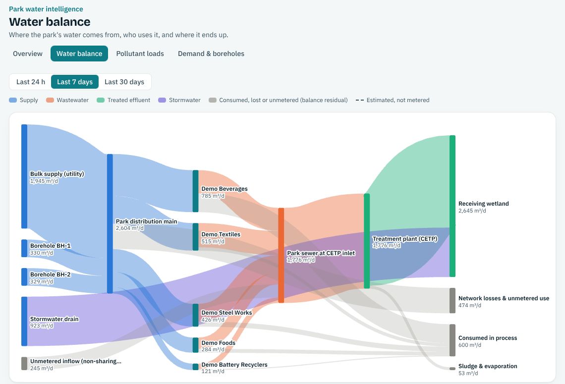
 HydroSaaS
Water balance, pollutant loads and sources, demand and borehole drawdown, and effluent compliance against NEMA limits.
Free plan · paid from $99 per month
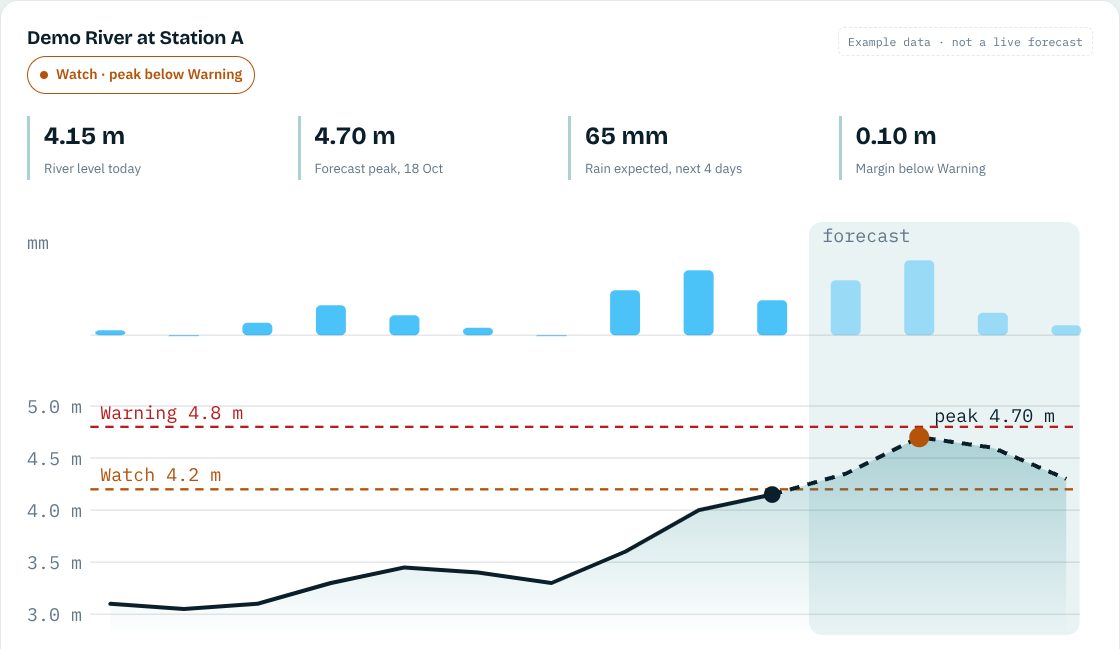
 KAI-Hydro
Parametric flood triggers back-tested against river gauges, and daily flood and drought forecasts ending in a plain Normal, Watch or Warning.
Free plan · paid from $190 per month
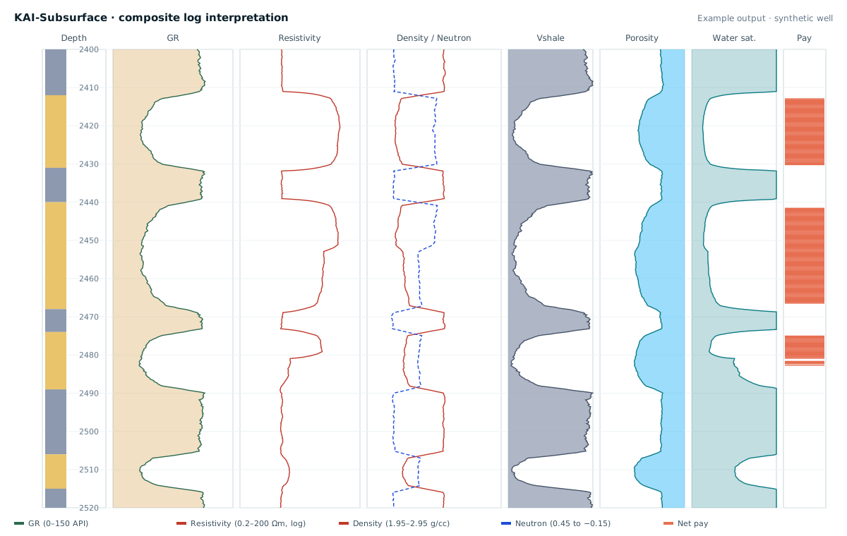
 KAI-Subsurface
Fixed-price well-log interpretation, geomodels and AI property prediction between wells.
Free plan · paid from $490 per well
KAI-Twin: questions and answers
What will KAI-Twin do?
A live model of a basin, wellfield or network fed by sensors and satellites, with “what if” scenarios (flood, drought, pump failure) and one picture for planners and operators.
What data would a digital twin need?
The network or wellfield layout and the sensors you already run (levels, flows, pressures, pumps). We add weather and satellite data and keep the model in step with your readings.
How do I join early access?
Join free from the KAI-Twin page; early-access members get the introductory price when it launches.